


bdr17_dBrenetsVallorbe

My Switzerland
Optez pour le retour à la nature GUIDE+
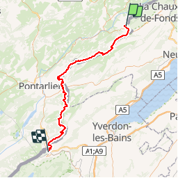

Length
71 km

Max alt
1306 m

Uphill gradient
2547 m
Km-Effort
105 km

Min alt
750 m

Downhill gradient
2495 m
Boucle
No
Creation date :
2014-12-10 00:00:00.0
Updated on :
2014-12-10 00:00:00.0
23h37
Difficulty : Unknown

FREE GPS app for hiking
 SityTrail
IGN / Geographical institutes
SityTrail Plus
The world is yours!
About
Trail Other activity of 71 km to be discovered at Neuchâtel, Unknown, Le Locle. This trail is proposed by My Switzerland.
Positioning
Country:
Switzerland
Region :
Neuchâtel
Department/Province :
Unknown
Municipality :
Le Locle
Location:
Les Brenets
Start:(Dec)
Start:(UTM)
324997 ; 5215014 (32T) N.
Comments